
Flight Navigation System Market Size and Share
Market Overview
| Study Period | 2020 - 2031 |
|---|---|
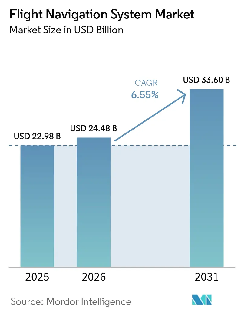
| Market Size (2026) | USD 24.48 Billion |
| Market Size (2031) | USD 33.60 Billion |
| Growth Rate (2026 - 2031) | 6.55 % |
| Fastest Growing Market | Asia Pacific |
| Largest Market | North America |
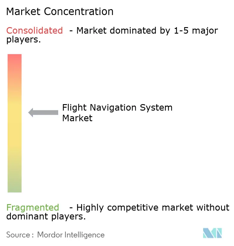
| Market Concentration | Medium |
Major Players *Disclaimer: Major Players sorted in no particular order Image © Mordor Intelligence. Reuse requires attribution under CC BY 4.0. | |
Flight Navigation System Market Analysis by Mordor Intelligence
The flight navigation system market size was valued at USD 22.98 billion in 2025 and estimated to grow from USD 24.48 billion in 2026 to reach USD 33.6 billion by 2031, at a CAGR of 6.55% during the forecast period (2026-2031). The current growth momentum reflects rising aircraft deliveries, mandatory NextGen and SESAR upgrades, and rapid adoption of AI-enabled sensor fusion across flight decks. Demand also benefits from expanding urban air mobility corridors, where centimeter-level positioning and low-latency data links are critical. Meanwhile, multi-layered redundancy architectures combining satellite-based augmentation, inertial sensors, and terrestrial aids lower fuel burn and increase airspace capacity. These advantages help offset the mounting cybersecurity and spectrum-interference risks that accompany higher system complexity.
Key Report Takeaways
- By communication technology, radio communication led with a 39.10% revenue share in 2025. The growing demand for UAV and long-range UAS navigation reliability is expected to increase at an 8.78% CAGR from 2026 to 2031.
- By platform, civil and commercial aviation accounted for 40.80% of the flight navigation system market share in 2025, whereas military aviation is projected to advance at a 9.05% CAGR through 2031.
- By flight instrument, autopilot systems held a 28.85% share of the flight navigation system market in 2025, and gyroscope instruments are expanding at the fastest rate, with a 9.98% CAGR.
- By system type, radar systems contributed a 31.10% share in 2025, while collision avoidance systems posted the highest CAGR of 6.44% to 2031.
- By component, hardware dominated with a 38.95% share in 2025, but software solutions are registering a 7.15% CAGR as cloud-native architectures gain traction.
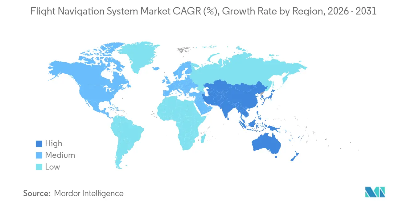
- By geography, North America retained a 35.20% share in 2025; however, the Asia-Pacific region is projected to grow at a 7.95% CAGR, reflecting fleet expansion in China and India.
Note: Market size and forecast figures in this report are generated using Mordor Intelligence’s proprietary estimation framework, updated with the latest available data and insights as of 2026.
Market Trends and Insights
Drivers Impact Analysis of Flight Navigation System Market*
| Driver | ( ~ ) % Impact on CAGR Forecast | Geographic Relevance | Impact Timeline |
|---|---|---|---|
| Satellite-based augmentation (SBAS) and NextGen/SESAR mandates | +1.2% | North America and Europe, expanding to APAC | Medium term (2-4 years) |
| Rising global commercial aircraft fleet | +1.8% | Global, with APAC leading growth | Long term (≥ 4 years) |
| Shift to performance-based navigation (PBN) standards | +1.5% | Global, ICAO member states | Medium term (2-4 years) |
| Growing demand for UAV and long-range UAS navigation reliability | +0.9% | North America and Europe, emerging in APAC | Short term (≤ 2 years) |
| Urban-air-mobility corridor integration needs | +0.8% | Major metropolitan areas globally | Long term (≥ 4 years) |
| AI-driven sensor-fusion redundancy for zero-fail cockpits | +0.6% | Advanced aviation markets | Medium term (2-4 years) |
| Source: Mordor Intelligence | |||
Satellite-Based Augmentation Systems Drive Infrastructure Transformation
EGNOS secured a EUR 51 million (USD 60.01 million) extension through 2028, enabling European airports to support precision approaches without the need to install new ground beacons.[1] Similar programs in Korea and sub-Saharan Africa have mirrored this success, prompting airlines to retire older receivers in favor of SBAS-ready hardware. Mandatory compatibility clauses within NextGen and SESAR accelerate equipment replacement cycles and promote global interoperability, which lowers pilot-training hours and flight-planning overheads. Airlines welcome lower ground-station maintenance costs because satellite signals deliver the required accuracy for Required Navigation Performance operations. These combined factors amplify upgrade demand across every fleet segment.
Commercial Fleet Expansion Fuels Navigation System Demand
Airbus and Boeing's order books returned to pre-pandemic levels in 2024, prompting OEMs like Thales to report EUR 6.4 billion (USD 7.54 billion) in avionics orders for flight management and navigation suites.[2] Airlines prioritize continuous-descent and dynamic-routing software that cuts fuel burn and carbon penalties. Concurrently, more-electric aircraft architectures are inviting integrated computing platforms that consolidate navigation, communication, and flight-control tasks to reduce weight. Software-defined navigation unlocks over-the-air feature updates, protecting asset value across long service lives.
Performance-Based Navigation Standards Reshape Operational Requirements
ICAO’s latest Annex 11 revisions ask member states to monitor satellite integrity and protect air-ground data links from cyber compromise. Airlines adopting Performance-Based Navigation fly shorter tracks and optimized vertical paths, boosting capacity at congested hubs. Tiered Required Navigation Performance levels reward carriers that invest in the most precise receivers yet remain backward-compatible with older fleets. Real-time weather overlays inside flight management computers help dispatchers adjust trajectories and avoid turbulence without violating airspace restrictions.
UAV Navigation Reliability Drives Technology Innovation
ICAO’s framework for remotely piloted aircraft mandates precise navigation performance for beyond-visual-line-of-sight (BVLOS) flights, creating demand for resilient inertial sensors blended with AI diagnostics. Quantum-enhanced gyros under development promise four-hour accuracy without GPS, as demonstrated in Boeing trials conducted in March 2025. The same technology appears attractive for long-range military UAS, which must function in jamming scenarios, prompting suppliers to harden systems against electronic attacks.
Restraints Impact Analysis of Flight Navigation System Market*
| Restraint | ( ~ ) % Impact on CAGR Forecast | Geographic Relevance | Impact Timeline |
|---|---|---|---|
| High upgrade and certification costs | -0.8% | Global, smaller operators most affected | Short term (≤ 2 years) |
| Cyber-jamming and spoofing vulnerabilities | -1.1% | Global, heightened in conflict regions | Short term (≤ 2 years) |
| 5G spectrum re-allocation crowding navigation bands | -0.7% | North America and Europe, expanding globally | Medium term (2-4 years) |
| Rare-earth magnet shortages for MEMS gyros | -0.5% | Global supply chains | Long term (≥ 4 years) |
| Source: Mordor Intelligence | |||
Cybersecurity Threats Expose Navigation Vulnerabilities
Confirmed GPS spoofing incidents rose sharply in 2024, disrupting commercial flights over conflict zones and compelling operators to fit multi-source positioning backups. Such redundancy raises costs and certification workloads. Manufacturers now embed quantum-grade inertial sensors to maintain accuracy during outages, while airlines invest in real-time monitoring to flag anomalous satellite data. Governments respond with spectrum-monitoring networks, but full deployment remains years away.
5G Spectrum Interference Challenges Radar Altimeter Operations
The FAA continues to assess C-band 5G interference with radar altimeters, imposing temporary approach restrictions at several airports during poor visibility.[3] Airlines must budget for filter retrofits or new altimeters, especially on widebody fleets operating across multiple regions with differing spectrum rules. This unplanned expenditure pressures smaller carriers and slows the adoption of other advanced avionics.
*Our forecasts treat driver/restraint impacts as directional, not additive. The impact forecasts reflect baseline growth, mix effects, and variable interactions.
Flight Navigation System Market Segment Analysis
By Communication Technology:
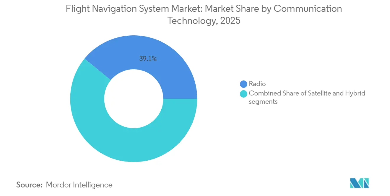
Hybrid Architectures Gain MomentumRadio links accounted for 39.10% of 2025 revenue, owing to entrenched VHF infrastructure and worldwide regulatory mandates. Yet, hybrid GNSS-SBAS solutions are set to outpace all other technologies with an 8.78% CAGR, illustrating the industry's shift toward precision approaches and oceanic coverage without ground aids. The flight navigation system market size for hybrid solutions is projected to grow faster than any other communication category, supported by satellite operators launching dedicated ADS-B constellations that feed real-time traffic data to crews.
Satellite communication gains relevance on polar and transoceanic routes, while software-defined radios enable dynamic frequency selection to mitigate interference. The combination of space-based receivers and ground networks equips airlines with resilient links that underpin future four-dimensional trajectory management exercises. Thales’ 100-satellite ADS-B program exemplifies this migration toward integrated surveillance and communications, reducing hardware counts and certification costs by utilizing standard avionics modules.

By Platform:
Military Modernization Accelerates OrdersCivil and commercial fleets controlled 40.80% of the flight navigation system market share in 2025, driven by the replacement of aging narrowbody aircraft and the rebound in passenger demand. Militaries drive the highest spending velocity with a 9.05% CAGR as nations pursue sovereign navigation capacity immune to foreign GNSS signals. These programs frequently bundle electronic-warfare filters, redundant inertial sensors, and AI-assisted mission planning in the same cockpit server to cut wiring and weight.
The Global Combat Air Programme’s (GCAP's) sixth-generation fighter concept demonstrates that sensor fusion and adaptive navigation will underpin future air superiority platforms. At the same time, eVTOL air taxis, categorized under urban air mobility, begin to specify certified antennas and multi-frequency receivers designed for low-altitude corridors. This demand for diversity sustains backlog for platform-agnostic avionics suites that can be repackaged across fighters, freighters, and flying taxis with minimal requalification.
By Flight Instrument:
Gyroscopes Lead Next-Wave InnovationAutopilot computers held the largest instrument share at 28.85% in 2025, reflecting their indispensable role in managing long-haul workloads. Gyroscope instruments are expected to register the sharpest climb at a 9.98% CAGR through 2031, as MEMS refinement and quantum sensing unlock centimeter-level drift characteristics. The resulting performance permits zero-fail cockpits to sustain navigation precision during prolonged GNSS outages, a feature crucial for military and transpolar flights.
Optical gyros from Anello Photonics achieved 0.1% error over 100 kilometers in field trials, underscoring the pace of improvement. Advances in sensor fusion algorithms further reduce position uncertainty by blending gyro, accelerometer, air-data, and celestial cues inside a standard Kalman filter, bolstering resilience against spoofing attacks. These developments power the flight navigation system market by enabling lower-cost inertial reference units suited to small UAVs and eVTOLs.
By System Type:
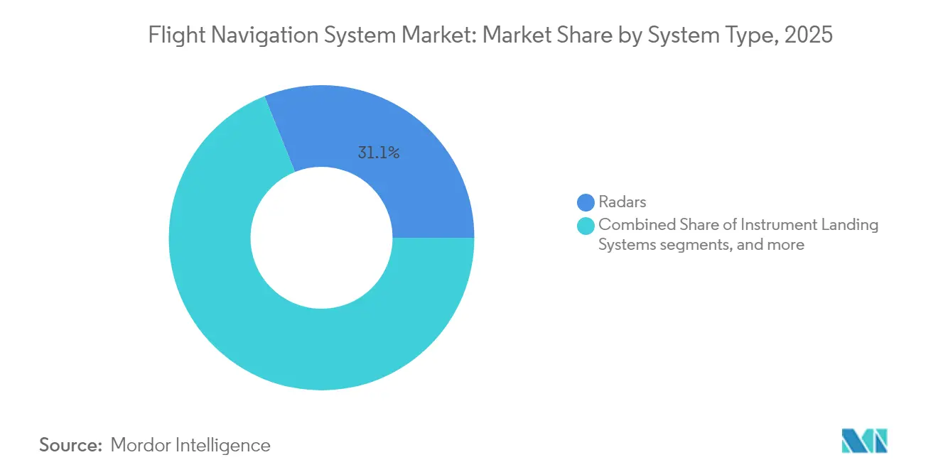
Surveillance and Safety ConvergeRadar systems retained a 31.10% share in 2025 because civilian and defense operators depend on them for weather and terrain awareness. Yet collision-avoidance suites grew at a 6.44% CAGR as ICAO implemented enhanced surveillance mandates supported by space-based ADS-B broadcasts. The flight navigation system market size for collision-avoidance hardware and software is forecast to expand steadily as autonomous aircraft require machine-speed conflict resolution.
Simultaneously, inertial navigation remains a core capability for operators flying in GPS-denied areas. At the same time, instrument landing systems (ILS) survive thanks to regulatory insistence on dual-path redundancy during low-visibility approaches. Suppliers, therefore, bundle weather radar, traffic collision avoidance, and precision landing modules into integrated racks that cut lifecycle overhead.
By Component:
Software Transforms Value CreationHardware accounted for 38.95% of the revenue in 2025, primarily driven by cockpit display units, antennas, and inertial sensors. Software represents the faster-moving frontier, rising at 7.15% CAGR on the back of cloud-native flight planning, predictive maintenance dashboards, and AI copilots. The flight navigation system industry increasingly views over-the-air updates as the key to life-cycle economics; Garmin’s SmartCharts and FlightPath3D’s “Luci” exemplify user-interface innovations that drive subscription revenue.
Edge-cloud synchronization allows crews to receive real-time weather layers and optimized routing mid-flight, while ground engineers monitor health metrics streamed from each line-replaceable unit. This architecture reduces unscheduled maintenance and supports faster certification of minor function releases, strengthening supplier aftermarket ties.
Geography Analysis
North America Flight Navigation System Market
North America kept its leadership with a 35.20% share in 2025, underpinned by steady NextGen funding, strong business-jet production, and the FAA's proactive rulemaking on powered-lift aircraft. Area navigation route additions such as Q-143 and T-467 show that en-route efficiency upgrades persist even as passenger numbers rebound. The region's broad adoption of over-the-air software updates positions it as a proving ground for cloud-based navigation analytics that feed directly into dispatch-center algorithms.
APAC Flight Navigation System Market
The Asia-Pacific region is the fastest-growing arena, with a 7.95% CAGR from 2021 to 2031. China and India dominate the order books for narrowbody jets, while regional governments allocate capital toward satellite-based augmentation and unmanned traffic management frameworks. Thales's new MRO facility in the Delhi-NCR region and its UTM roadmap agreement with Thai authorities illustrate a supplier's pivot toward local engineering hubs, which can reduce time-to-certification for indigenous carriers. These moves accelerate the adoption of hybrid GNSS-SBAS receivers across new single-aisle fleets.
Europe Flight Navigation System Market
Europe registers solid gains as SESAR-driven PBN procedures proliferate, and the European Union Aviation Safety Agency finalizes comprehensive VTOL regulations that establish navigation performance baselines for urban air mobility. The EGNOS service life extension to 2028 safeguards low-visibility operations for more than 400 airports, thereby sustaining demand for SBAS-capable flight management systems and precision approach displays. Sustainability priorities are driving airlines to adopt trajectory prediction tools that enable continuous-descent arrivals, thereby reinforcing the role of predictive analytics within cockpit servers.
Regulatory Landscape
Certification and operational compliance for flight navigation systems are anchored on airworthiness requirements and software assurance standards, with RTCA DO-178C (airborne software) and DO-254 (airborne electronic hardware) commonly used to demonstrate safety objectives. In Europe, EASA CS-ACNS sets certification specifications for airborne communications, navigation, and surveillance, including performance-based navigation (PBN) expectations aligned to RNP/RNAV equipage and procedure compliance.
Recent updates reinforce harmonization and ongoing modernization. In May 2026, EASA published CS-23 Amendment 6 alongside updated AMC and GM for normal-category aeroplanes, incorporating revised ASTM F44 standards to improve alignment with FAA practices. Separately, EASA ED Decision 2026/005/R updated elements of the airworthiness review process and aligned implementation with the EU aviation safety framework under Regulation (EU) 2018/1139, shaping approval, import, and continued-airworthiness pathways for aircraft and installed navigation equipment.
Value Chain Analysis
The flight navigation system value chain starts upstream with GNSS and augmentation infrastructure (space and ground segments), electronics and sensor inputs (IMUs, gyros, antennas, processors, displays), and software toolchains used to develop and verify safety-critical code. Midstream, avionics OEMs integrate sensors, flight management/navigation computers, radios, and surveillance modules into certified line-replaceable units and cockpit suites, then support qualification testing and documentation packages aligned to standards such as DO-178C/DO-254. Downstream, aircraft OEM linefit programs and retrofit channels (STCs, service bulletins, and MRO installations) deliver equipment to airlines, business aviation operators, and defense fleets, followed by long-duration aftermarket support covering databases, software updates, calibration, and repairs.
Infrastructure modernization and resilience investments shape demand signals and component availability across the chain. For example, the European SBAS backbone is being sustained through the EUR 51 million EUSPA contract awarded to Thales Alenia Space to extend EGNOS service life beyond 2028, reinforcing a multi-year pull for SBAS-capable receivers and flight management upgrades. In the United States, GPS modernization spending flows through both space and ground segments, including Lockheed Martin awards in 2026 for GPS IIIF satellites (SV23-24) and a GPS ground control modernization contract, supporting higher-integrity PNT services that avionics suppliers can incorporate into resilient navigation features. Industry efforts to reduce exposure to unapproved parts also affect procurement and traceability, highlighted by the Aviation Supply Chain Integrity Coalition launched in 2025 by Airbus, Boeing, GE Aerospace, and Safran.
Competitive Landscape
The flight navigation system market is moderately consolidated. Aerospace majors leverage deep certification expertise and long-standing customer relationships to protect their installed bases, while selectively divesting non-core assets. Boeing’s USD 10.55 billion sale of Jeppesen and ForeFlight to Thoma Bravo has refocused the airframer on hardware, creating a pure-play digital aviation platform for rapid subscription growth. Competing bidders such as Honeywell, GE, and RTX Corporation highlighted the strategic importance of flight-planning databases in next-generation cockpits.
New entrants differentiate through quantum sensing, optical gyros, and AI copilots. VIAVI Solutions’ USD 50 million purchase of Inertial Labs expands its inertial sensor lineup for both crewed and uncrewed platforms, mirroring the trend toward vertically integrated motion-sensing portfolios. Meanwhile, Thales Group, Garmin, and Honeywell race to supply multi-frequency antennas and open-architecture flight decks to eVTOL developers, anticipating urban-mobility certification within the decade.
Competitive intensity also manifests in collaborative space-based surveillance ventures. Thales, Spire Global, and ESSP are building a 100-satellite ADS-B service that promises globe-spanning traffic coverage by 2027. Access to such data feeds improves collision-avoidance algorithms and creates premium airline analytics services. Suppliers that pair hardware, data subscriptions, and predictive-maintenance dashboards stand to capture a larger lifetime value across fleets that now average over 20 years of service.
Flight Navigation System Industry Leaders
-
Honeywell International Inc.
-
RTX Corporation
-
Thales Group
-
Garmin Ltd.
-
Northrop Grumman Corporation
- *Disclaimer: Major Players sorted in no particular order
Flight Navigation System Market Companies Covered in this Report
- Honeywell International Inc.
- Collins Aerospace (RTX Corporation)
- Thales Group
- Garmin Ltd.
- Northrop Grumman Corporation
- Safran SA
- L3Harris Technologies Inc.
- BAE Systems plc
- General Electric Company
- Universal Avionics Systems Corporation (Elbit Systems Ltd.)
- Leonardo S.p.A
- Moog Inc.
- Avidyne Corporation
- Saab AB
- The Boeing Company
Market Opportunities and Future Outlook
A key whitespace area is resilient positioning, navigation, and timing (PNT) for GPS/GNSS-degraded operations across civil, business aviation, and defense platforms, spanning contested-environment military requirements and commercial routing through interference-prone regions. Product and program signals point to commercial readiness moving beyond concepts: in July 2026, Iridium announced commercial availability of its Iridium PNT ASIC for resilient GNSS protection applications, while Q-CTRL highlighted its Ironstone Opal quantum navigation system as an airworthiness-qualified GPS backup (RTCA DO-160). Together, these moves support demand for multi-layered architectures that combine inertial solutions, alternative absolute references (magnetic/vision/celestial), and robust data links into certified navigation suites.
Infrastructure and procedural modernization continues to open upgrade pathways for both avionics hardware and software, particularly for operators that need to meet PBN and data-link performance requirements without extending aircraft downtime. Eurocontrol roadmaps and European CNS modernization planning, along with FAA NAS modernization initiatives disclosed in early 2026, reinforce the shift toward more software-defined avionics, integrated flight deck computing, and compliant data-link equipage for advanced trajectory management. On the operator side, IFR equipage rules that require independent navigation capability in certain operations (for example, 14 CFR 135.165) keep redundancy a procurement priority, favoring suppliers that package certified receivers, inertial reference capability, cybersecurity monitoring, and continuously updated navigation databases into a single lifecycle offering.
Recent Industry Developments in Flight Navigation System Market
- July 2026: Garmin announced the AXIS family of highly integrated flight displays for certified piston aircraft and experimental/LSA platforms, combining primary flight display functions with IFR GPS, NAV/COMM radio, and audio panel capabilities. The 11.6-inch AXIS displays received FAA/EASA TSO certification, lowering barriers for owners seeking consolidated panel upgrades and a simpler installation footprint.
- June 2026: Honeywell introduced the Kestrel navigation system for Group 2 and 3 Collaborative Combat Aircraft, pairing the HG3900 inertial measurement unit with M-Code and multi-GNSS receivers for contested environments. The launch supports modular, jam-resistant navigation stacks designed for autonomous and uncrewed mission profiles.
- June 2024: Thales, Spire Global, and ESSP began building a satellite-based surveillance service planned around a 100-satellite ADS-B capability to collect global aircraft messages. Expanding space-based ADS-B coverage strengthens traffic awareness data feeds that can be fused into collision-avoidance and flight deck situational-awareness functions.
Flight Navigation System Market Report Scope and Research Methodology
Market Definition and Coverage
This market covers the revenue generated from flight navigation systems used to determine position, guide the aircraft along a planned route, and support safe approach and landing, including the related onboard equipment and software used for navigation functions.
Scope exclusions: We exclude general aircraft connectivity and entertainment systems, standalone pilot training services, and air traffic management ground infrastructure unless it is sold as part of an onboard navigation system package.
Segments Covered in This Report
- By Communication Technology
- Radio
- Satellite
- Hybrid (GNSS+SBAS)
- By Platform
- Civil and Commercial Aviation
- Business and General Aviation
- Military Aviation
- UAV/eVTOL
- By Flight Instrument
- Autopilot
- Altimeter
- Gyroscope
- Attitude Heading Reference System (AHRS)
- Sensors (IMU, Air-data, etc.)
- Magnetic Compass
- By System Type
- Radars
- Instrument Landing Systems (ILS)
- Inertial Navigation Systems (INS)
- Collision Avoidance Systems (CAS)
- GNSS/VOR-DME
- Other Systems
- By Component
- Hardware
- Software
- By Geography
- North America
- United States
- Canada
- Mexico
- Europe
- United Kingdom
- Germany
- France
- Rest of Europe
- Asia-Pacific
- China
- Japan
- India
- South Korea
- Rest of Asia-Pacific
- South America
- Brazil
- Argentina
- Rest of South America
- Middle East and Africa
- Middle East
- Saudi Arabia
- UAE
- Turkey
- Rest of Middle East
- Africa
- South Africa
- Rest of Africa
- Middle East
- North America
Data Sources, Market Sizing, and Validation
Desk Research
Desk work starts by building a clean view of aircraft fleets, deliveries, and modernization cycles, since these are the main demand anchors for navigation equipment. We rely on public sources such as FAA and EASA publications, ICAO data releases, and EUROCONTROL updates, along with aerospace trade association materials. Where relevant, we also review customs statistics to understand trade flows for avionics subassemblies.
Next, we pull supplier and airline signals from annual reports, investor presentations, regulatory filings, and reputable press releases, so the model inputs match what is being installed and certified. For cross-checking, we use paid subscriptions that cover company financials and intelligence, patent databases to track technology direction, and aircraft and engine databases to align fleet mix, retrofit windows, and platform build rates. These examples are not exhaustive, and we also consulted other public and paid sources for data collection, validation, and clarification.
Primary Interviews and Surveys
Primary checks were conducted through expert interviews and structured surveys with people working in avionics OEM programs, component suppliers, aftermarket support, and aircraft operators, so assumptions around line-fit versus retrofit and pricing were stress tested. Because this is a global market, inputs were validated across Americas, EMEA, and APAC to capture differences in certification pacing, upgrade mandates, and fleet age profiles.
Distribution of primary research fieldwork respondents
| Company type | Respondent position | Region |
|---|---|---|
| Top tier: 32% | CXOs: 19% | APAC: 44% |
| Mid tier: 49% | Functional/Unit leaders: 39% | EMEA: 36% |
| Smaller Players: 19% | Managers: 42% | Americas: 20% |
Market-Sizing & Forecasting
Sizing begins with a top-down build where fleet and delivery data are used to reconstruct the addressable install base, then those totals are applied to expected fit rates for navigation suites and key subsystems across civil and military aircraft. To keep results grounded, we corroborate with selective bottom-up approximations, such as sampled program volumes multiplied by typical system ASP ranges, followed by channel checks on retrofit activity.
Key inputs in the model include aircraft deliveries and active fleet by region, retrofit penetration linked to navigation performance requirements, typical shipset content by platform class, replacement cycles driven by MRO events, and ASP progression assumptions that reflect mix shifts between legacy aids and GNSS and INS led configurations. When the bottom-up view has gaps, we interpolate using platform proxies and certification driven upgrade schedules, and then adjust based on what interviewees describe as realistic adoption timing.
Forecasts are produced using scenario analysis supported by a light multivariate regression view, with delivery rates, utilization, and modernization timing as the main drivers. The final path is selected after aligning it with expert consensus on supply constraints, certification timelines, and budget cycles that can speed up or slow down upgrades.
Data Validation & Update Cycle
Outputs are validated through triangulation across demand anchors, pricing logic, and independent signals such as fleet growth and avionics upgrade announcements. When a variance looks unusual, we recheck assumptions and place follow-up calls to confirm whether the issue is scope, timing, or currency treatment.
Before sign-off, the model goes through multi-step analyst reviews, including cross-region reasonableness checks and year-over-year continuity tests. Reports are refreshed annually, and interim updates are made when material events occur, such as major certification changes, delivery shocks, or sharp currency moves. Right before publication, we run a final data pass so the delivered numbers reflect the latest available inputs.
Mordor Intelligence's Flight Navigation System Market Size Compared Against Other Published Estimates
Published market sizes for flight navigation systems often differ because the update timing and price assumptions are not the same, even when the titles appear similar. Variations also come from how studies treat line-fit versus retrofit timing, and whether revenues are counted at shipped hardware value or as broader system bundles.
In this study, a refresh-led approach is used where currency conversion timing is kept consistent for the stated year, and ASP logic is revalidated against recent platform mix and upgrade activity before the final numbers are locked. That process is also aligned with Mordor Intelligence, which helps explain part of the spread versus older snapshots.
Benchmark comparison
| Source | Market Size | Gaps in Research Methodology |
|---|---|---|
| Mordor Intelligence | USD 24.48 B (2026) | |
| Industry Publisher A | USD 24.75 B (2025) | Uses a different base year and may treat price levels and currency conversion as of its 2025 snapshot, which can shift the value even if unit demand is similar. The scope description is less explicit on how retrofit timing is recognized versus line-fit installs. |
| Global Publisher B | USD 19.64 B (2023) | Anchors the market to an earlier base year, so later upgrade waves and delivery normalization can be under-reflected. It also appears to aggregate adjacent avionics categories differently, which can compress the navigation-only revenue pool. |
Across the three figures, the gap is mainly explained by base-year choice, timing of refresh, and how ASPs are carried forward as platform mix changes. By keeping the scope tied to onboard navigation systems and rechecking the key inputs that move prices and adoption, the final estimate stays traceable to clear steps that a reader can repeat and audit.
Key Questions Answered in the Report
What is the current value of the flight navigation system market?
The market is valued at USD 24.48 billion in 2026.
How fast is the flight navigation system market expected to grow?
It is forecasted to expand at a 6.55% CAGR during 2026-2031, reaching USD 33.6 billion by 2031.
Which communication technology holds the largest share?
Radio communication leads with a 39.10% share, though hybrid GNSS-SBAS solutions are growing faster.
Why is Asia-Pacific the fastest-growing region?
Fleet expansion in China and India and major investments in air-traffic modernization drive the region’s 7.95% CAGR.
How will 5G networks impact flight navigation?
C-band 5G deployments can interfere with radar altimeters, pushing airlines to upgrade equipment and regulators to issue operating constraints.
What technological trend is most disruptive to future navigation systems?
Quantum-enhanced gyroscopes and AI-driven sensor fusion promise GPS-independent accuracy and zero-fail cockpit architectures.